
4th Infantry Division Campaign Route Map
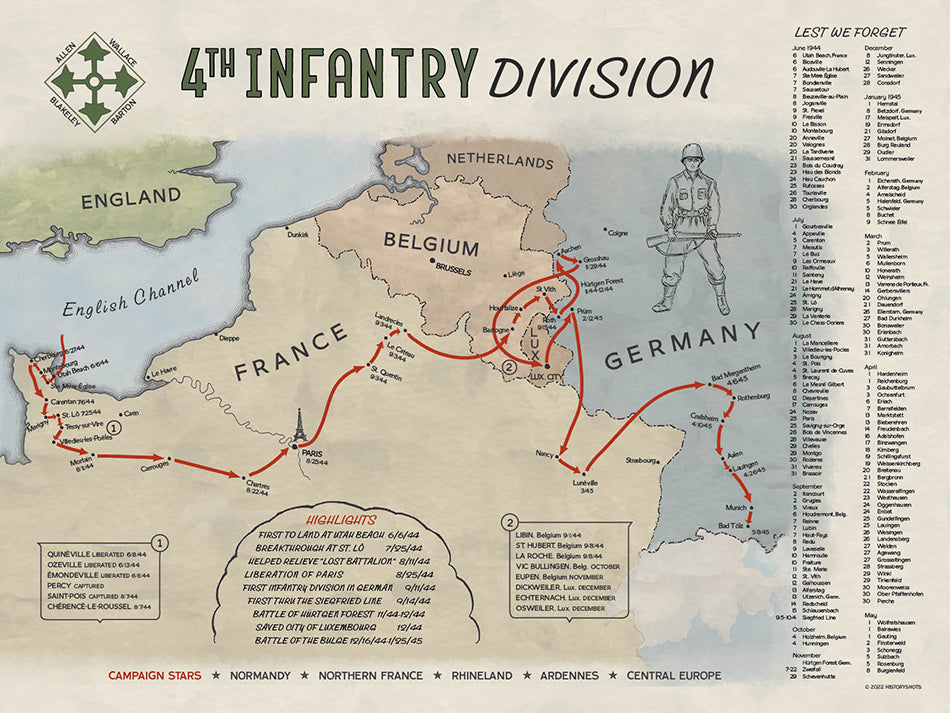
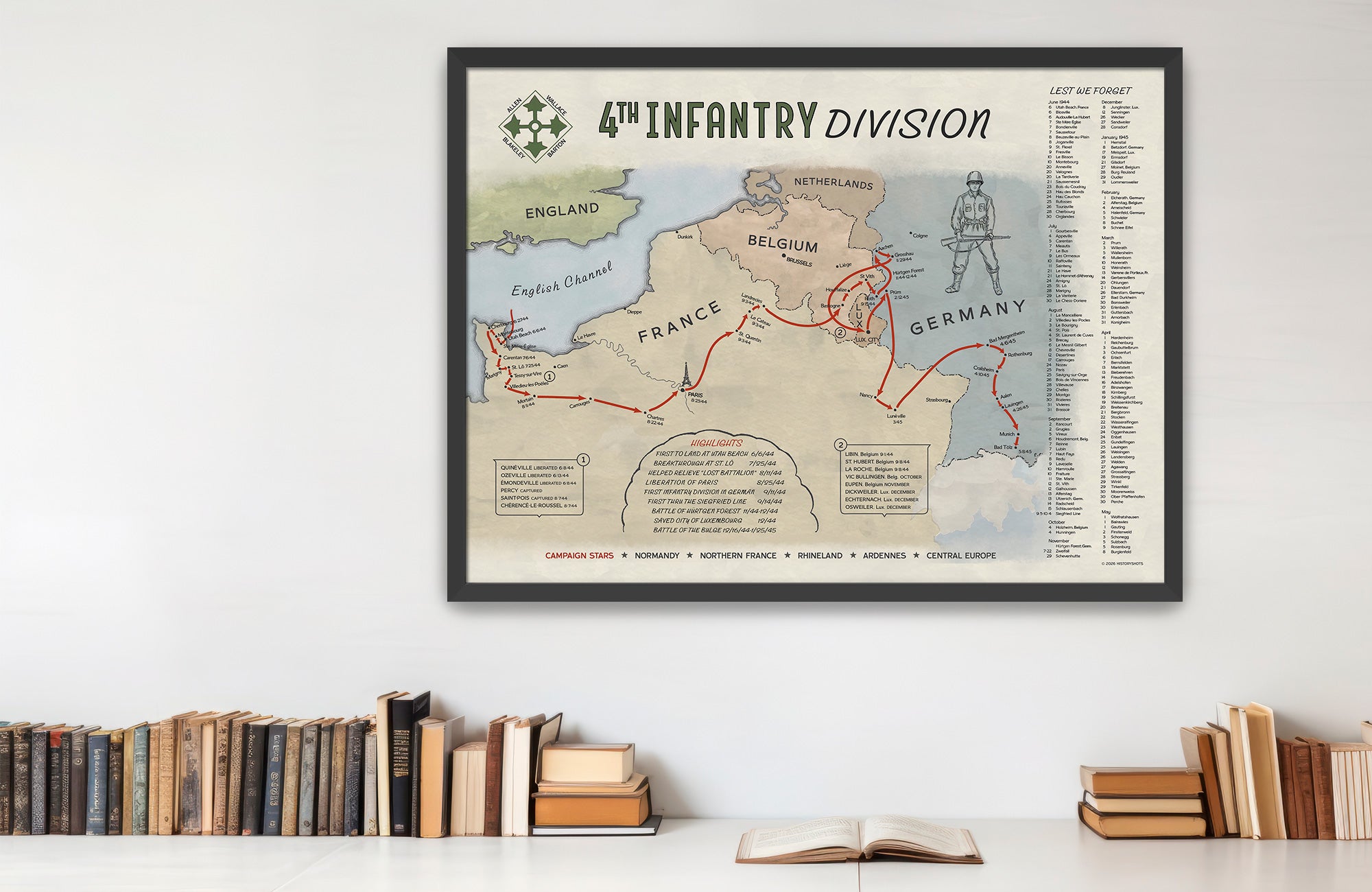
Chart the Ivy Division’s route from Utah Beach and Cherbourg to Paris, the Hürtgen Forest, Ardennes, Rhine, and southern Bavaria.
Size:
24 x 18
4th Infantry Division Campaign Route Map
If you have any questions, you are always welcome to contact us. We'll get back to you as soon as possible, within 24 hours on weekdays.
-
Shipping Information
Use this text to answer questions in as much detail as possible for your customers.
-
Customer Support
Use this text to answer questions in as much detail as possible for your customers.
-
FAQ’s
Use this text to answer questions in as much detail as possible for your customers.
-
Contact Us
Use this text to answer questions in as much detail as possible for your customers.
4th Infantry Division Campaign Route Map
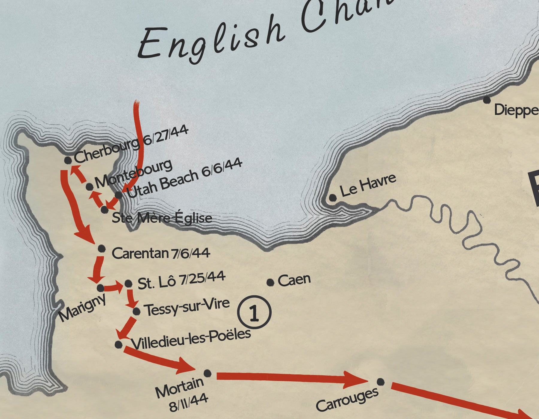
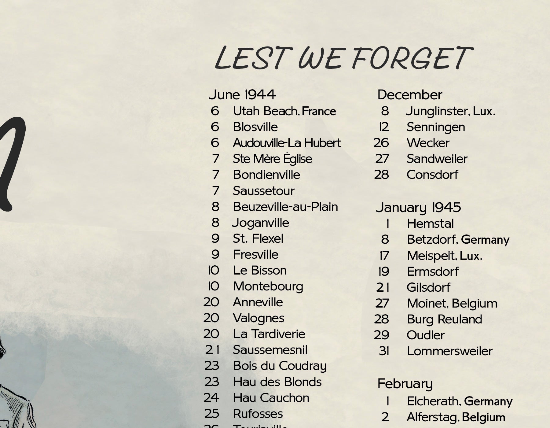
The 4th Infantry Division’s World War II route began on D-Day, when the Ivy Division landed on Utah Beach and moved inland to link with airborne troops near Sainte-Mère-Église. From there, the division drove north through the Cotentin Peninsula, fighting past fortified positions and helping capture Cherbourg, the vital port at the peninsula’s tip.
After returning south, the 4th Infantry joined the fighting near Périers and took part in the Cobra breakout. Its route then carried it across France to Paris, where it entered the capital alongside French forces in August 1944. By September, the division had moved into Belgium and toward the German frontier, penetrating the West Wall in the Schnee Eifel before entering one of its hardest campaigns.
In the Hürtgen Forest, the Ivy Division fought through dense woods, mines, artillery, and prepared German defenses in a costly battle that sharply limited movement. Shifted to Luxembourg in December, it was struck by the Ardennes offensive but held around Dickweiler, Osweiler, and Echternach, helping anchor the southern shoulder of the Bulge. In 1945, the division crossed the Rhine at Worms and advanced through Würzburg and Bavaria. The map shows a campaign that ran from D-Day’s landing beaches to Germany’s final collapse.
PAPER & PRINTING
Printed on archival-grade, acid-free matte fine-art paper with a natural surface for crisp detail, accurate color, and lasting display quality.