
1st Infantry Division WWII Campaign Route Map Print
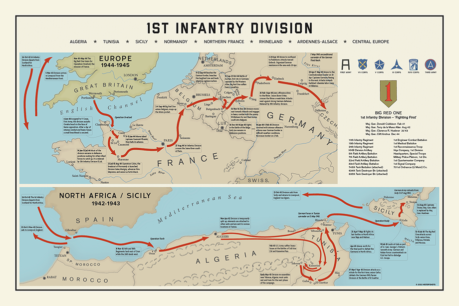
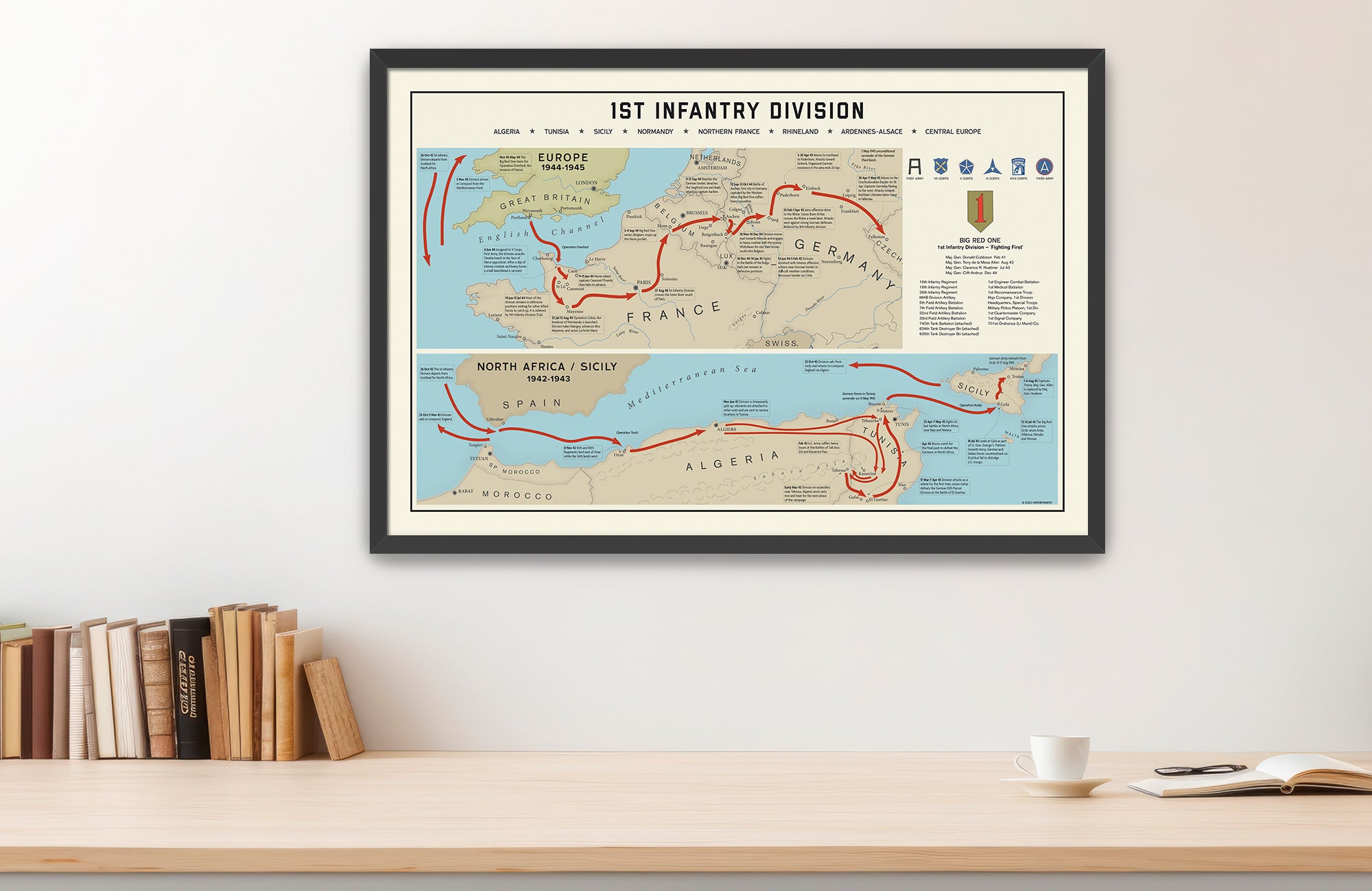
Trace the route of the “Big Red One” from North Africa and Sicily to Omaha Beach to the Ardennes, Remagen and Czechoslovakia.
Size:
30 x 20
1st Infantry Division WWII Campaign Route Map Print
If you have any questions, you are always welcome to contact us. We'll get back to you as soon as possible, within 24 hours on weekdays.
-
Shipping Information
Use this text to answer questions in as much detail as possible for your customers.
-
Customer Support
Use this text to answer questions in as much detail as possible for your customers.
-
FAQ’s
Use this text to answer questions in as much detail as possible for your customers.
-
Contact Us
Use this text to answer questions in as much detail as possible for your customers.
1st Infantry Division WWII Campaign Route Map Print
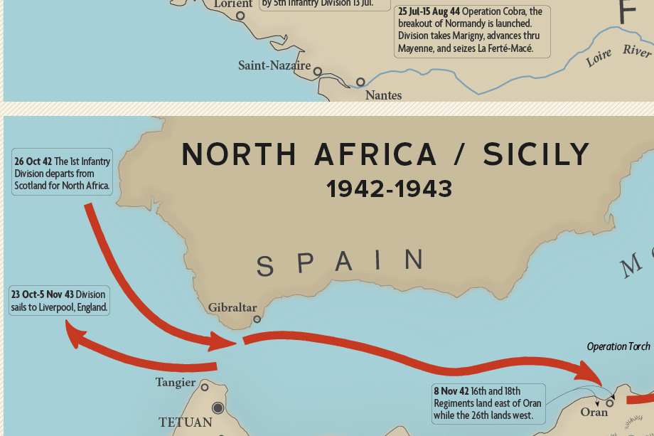
The 1st Infantry Division’s route stretches across one of the longest and most varied combat records of any American division in World War II. Known as the “Big Red One,” the division first entered combat during Operation Torch in November 1942, landing near Oran before moving east into Tunisia. There, it fought through a demanding campaign that tested American infantry against experienced German and Italian forces.
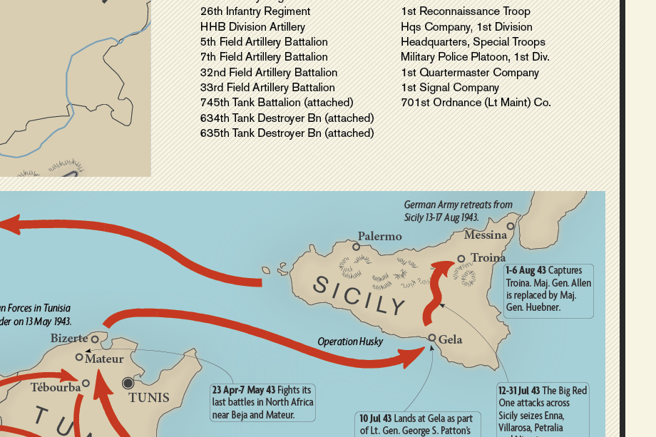
In July 1943, the division assaulted Sicily, fighting across difficult terrain before moving to England to prepare for the invasion of France. On June 6, 1944, the Big Red One landed on Omaha Beach, where its assault units faced devastating fire in one of the defining actions of D-Day. After pushing through the Normandy hedgerows and joining the Cobra breakout, the division advanced across France and Belgium to the German frontier.
At Aachen, the 1st Infantry Division played a central role in the capture of the first major German city taken by Allied forces. It later helped hold the northern shoulder of the Ardennes offensive, crossed the Rhine from the Remagen bridgehead, and advanced through Germany into Czechoslovakia. The map presents the division’s campaign as a continuous movement from early American combat in North Africa to the final Allied advance in Central Europe.
This is the only detailed route map available that traces the Big Red One's movements during World War II.
PAPER & PRINTING
Printed on archival-grade, acid-free matte fine-art paper with a natural surface for crisp detail, accurate color, and lasting display quality.