2nd Armored Division Campaign Map 1945 Version
Trace the route of “Hell on Wheels” from North Africa and Sicily through Normandy, the Ardennes, the Rhine, and the final advance to the Elbe.
Size:
34 x 24
2nd Armored Division Campaign Map 1945 Version
If you have any questions, you are always welcome to contact us. We'll get back to you as soon as possible, within 24 hours on weekdays.
-
Shipping Information
Use this text to answer questions in as much detail as possible for your customers.
-
Customer Support
Use this text to answer questions in as much detail as possible for your customers.
-
FAQ’s
Use this text to answer questions in as much detail as possible for your customers.
-
Contact Us
Use this text to answer questions in as much detail as possible for your customers.
2nd Armored Division Campaign Map 1945 Version
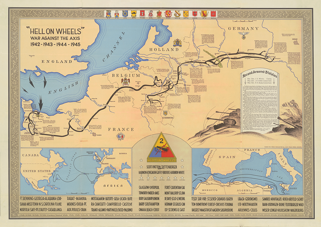
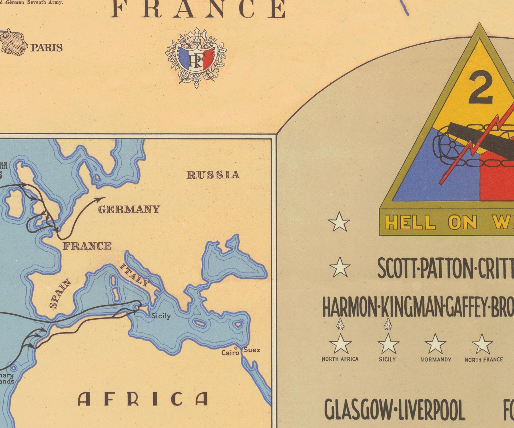
This map follows the full World War II route of the 2nd Armored Division, “Hell on Wheels,” from North Africa and Sicily to the final Allied advance into Germany. The division first saw combat during Operation Torch in November 1942, then fought as a full formation in Sicily before moving to England to prepare for the invasion of France.
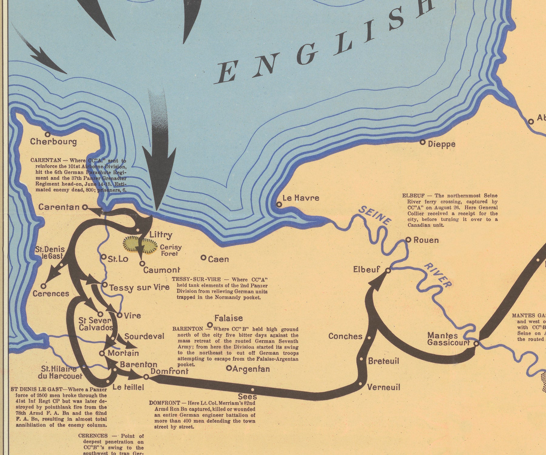
Landing in Normandy on June 9, 1944, the 2nd Armored fought near Carentan and then drove into the breakout created by Operation Cobra. Its columns advanced across France into Belgium and reached the German frontier, where the pace of the campaign slowed against fortified positions, rivers, and counterattacks. During the Ardennes offensive, the division helped stop the forward elements of the German 2nd Panzer Division near Celles, blocking one of the deepest German penetrations toward the Meuse.
In 1945, Hell on Wheels crossed the Roer, advanced to the Rhine, and crossed the river in late March. The division helped close the Ruhr Pocket, pushed east through central Germany, and reached the Elbe near Magdeburg in April. Seen as a continuous route, the map presents the 2nd Armored Division’s campaign as a movement from early amphibious operations to armored pursuit, winter crisis, and the final drive across Germany.
Companion Map
A companion 1944 version is also available, showing an alternate wartime view of the division’s route through 1944.
PAPER & PRINTING
Printed on archival-grade, acid-free matte fine-art paper with a natural surface for crisp detail, accurate color, and lasting display quality.