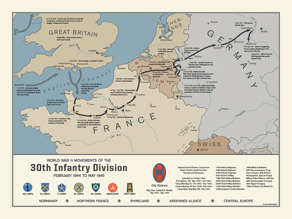
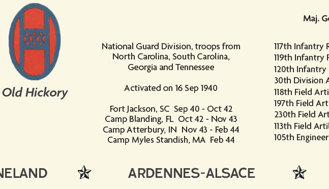
30th Infantry Division Campaign Map
Campaigns of the 30th Infantry Division is a visual history of the Old Hickory division during World War II.
Size:
24 x 18
30th Infantry Division Campaign Map
If you have any questions, you are always welcome to contact us. We'll get back to you as soon as possible, within 24 hours on weekdays.
-
Shipping Information
Use this text to answer questions in as much detail as possible for your customers.
-
Customer Support
Use this text to answer questions in as much detail as possible for your customers.
-
FAQ’s
Use this text to answer questions in as much detail as possible for your customers.
-
Contact Us
Use this text to answer questions in as much detail as possible for your customers.
30th Infantry Division Campaign Map
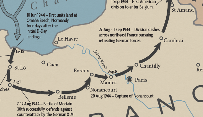
The 30th Infantry Division’s World War II route began shortly after D-Day, when Old Hickory landed on Omaha Beach on June 10, 1944. Entering combat the next day, the division fought through the Normandy hedgerows, secured crossings near the Vire-et-Taute Canal and Vire River, and helped spearhead the Saint-Lô breakout in late July.
Its defining early test came at Mortain. After relieving the 1st Infantry Division in the area, the 30th was hit by the German counterattack toward Avranches. Fighting in place from August 7 to 12, the division helped break the enemy spearhead and protect the Allied breakout from being cut off. From there, Old Hickory moved east through Belgium, crossed the Meuse, entered the Netherlands, and joined the attack against the Siegfried Line and Aachen.
In December, the division was rushed south to the Malmedy-Stavelot sector during the Battle of the Bulge, helping block the northern advance of German armored forces. In 1945, it crossed the Roer and Rhine, then advanced across northwestern Germany toward Hamelin, Braunschweig, Magdeburg, and the Elbe. The map shows a campaign shaped by hard defensive stands and steady offensive movement from Normandy into Germany.
PAPER & PRINTING
Printed on archival-grade, acid-free matte fine-art paper with a natural surface for crisp detail, accurate color, and lasting display quality.