
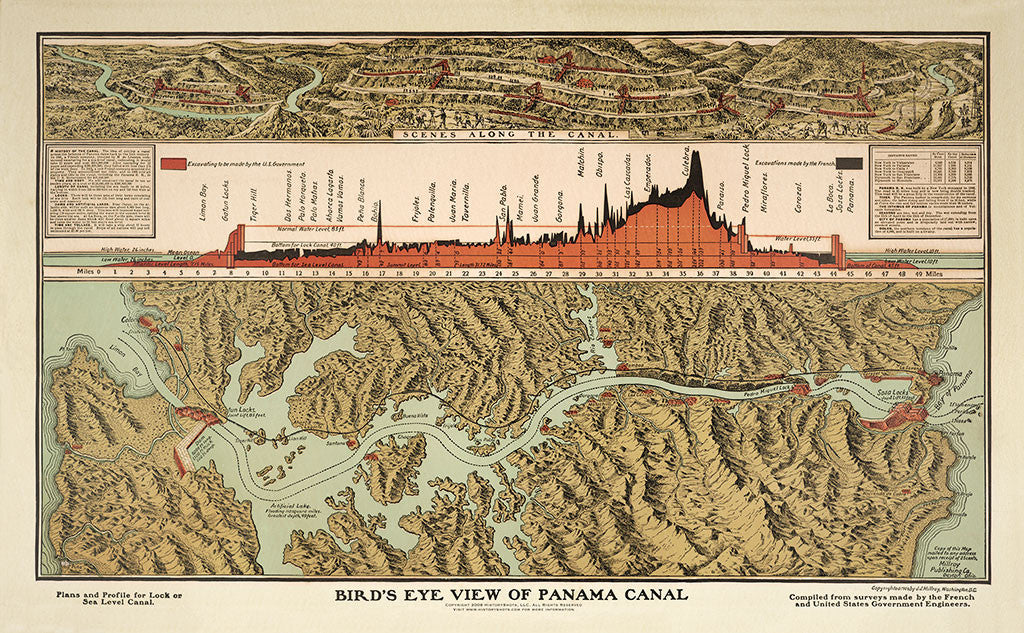
Bird's Eye View of Panama Canal
A bird’s-eye map of the Panama Canal, showing the canal route, locks, cities, excavation profile, and engineering details from the era of its construction.
Size:
25 x 16
Bird's Eye View of Panama Canal
If you have any questions, you are always welcome to contact us. We'll get back to you as soon as possible, within 24 hours on weekdays.
-
Shipping Information
Use this text to answer questions in as much detail as possible for your customers.
-
Customer Support
Use this text to answer questions in as much detail as possible for your customers.
-
FAQ’s
Use this text to answer questions in as much detail as possible for your customers.
-
Contact Us
Use this text to answer questions in as much detail as possible for your customers.
Bird's Eye View of Panama Canal
This restored Panama Canal print combines a bird’s-eye map of the canal route with a profile chart showing the scale of excavation required to complete the project. Begun by the French in 1880 and completed by the United States in 1914, the canal was one of the major engineering works of the early twentieth century.
The map follows the canal from the Bay of Panama to Limon Bay, identifying the locks, major cities, and important points along the route. The profile at the top shows the excavation by country, giving a second view into the construction of the canal and the terrain it crossed.
The original graphic noted that ships were expected to take about 12 hours to pass through the canal, at an estimated cost of about $2.00 per ton. This image was featured in PBS’s American Experience.
PAPER & PRINTING
Printed on archival-grade, acid-free matte fine-art paper with a natural surface for crisp detail, accurate color, and lasting display quality.